AW
Aruba
Sun-guaranteed Dutch Caribbean — Eagle Beach, trade winds & natural pool
Sun-guaranteed Dutch Caribbean — Eagle Beach, trade winds & natural pool
Aruba is the most polished and sun-guaranteed island in the Dutch Caribbean — a small, flat limestone island off the coast of Venezuela where the trade winds blow year-round, the sun shines 90% of the time and the beach at Eagle and Palm Beach is a 7-kilometre stretch of powder-white sand and turquoise water widely rated among the world’s finest. Aruba sits outside the hurricane belt, making it a reliable year-round destination. The island’s Dutch heritage, multicultural character (Arubans speak four languages: Papiamento, Dutch, English and Spanish) and sophisticated resort infrastructure make it the most overtly international island in the southern Caribbean. The natural pool, natural bridge ruins and the painted-cave art of Arikok National Park offer a different Aruba from the beach strip.
Eagle Beach, consistently rated one of the world’s top five beaches, has a wide expanse of white sand with shallow, calm, turquoise water and far less resort density than the adjacent Palm Beach strip. Palm Beach provides the full resort experience — beach bars, watersports, parasailing and the neon of the high-rise hotel zone. The trade wind keeps both comfortably cool even at noon.
A natural freshwater pool in a collapsed lava formation on Aruba’s rugged north coast, accessible only by 4WD across the desert landscape of Arikok National Park. The pool fills with ocean water at high tide through a natural opening in the lava — swimming in it while waves crash on the rocks outside is one of Aruba’s most memorable experiences.
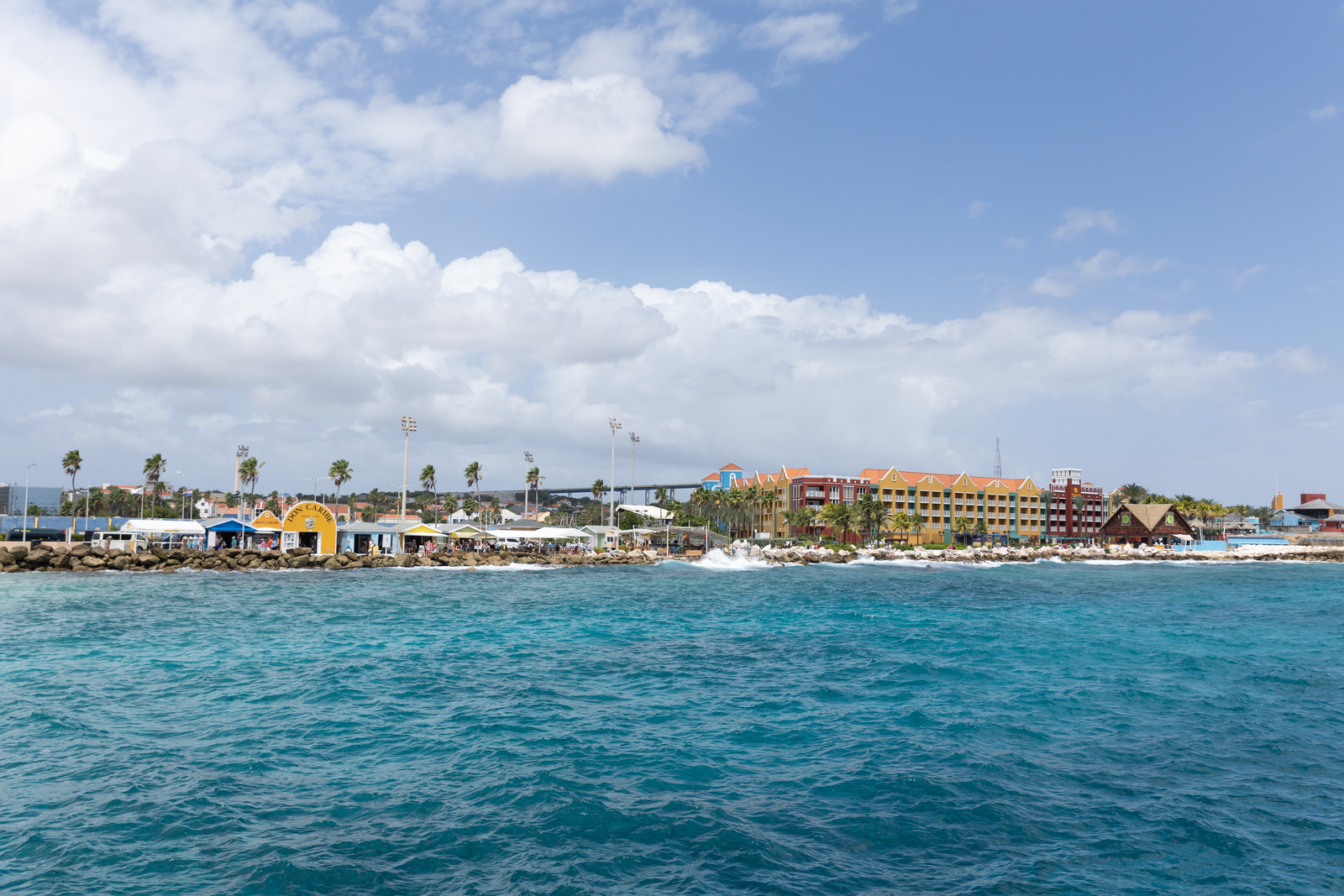
Aruba’s capital is a colourful Dutch colonial city of yellow and orange gabled buildings along a waterfront of yachts and ferries. The Renaissance Marina and the renovated downtown with its Dutch-Caribbean architecture and multi-lingual retail reflect the island’s four-language, multicultural character. Fort Zoutman (1796) is Aruba’s oldest building.
Aruba (Wikipedia) →a whole Edam or Gouda cheese shell stuffed with spiced chicken, raisins and olives — the national dish) is unique to the Dutch Caribbean.
A fluffy, slightly sweet cornmeal pancake — descended from the Arawak corn tradition, now a staple side dish alongside fish, keshi yena and stoba (stew). Cooked on a griddle and served hot at most Aruban restaurants.
polenta with okra) are traditional sides. Fresh
The dorado (dolphin fish) is one of the most abundant fish in Aruban waters — caught fresh daily and served grilled with lemon butter, in fish tacos or as ceviche. Its firm, sweet white flesh is one of the finest eating fish in the Caribbean.
One of the fastest fish in the ocean and one of the finest to eat — caught off the north coast of Aruba by sport and commercial fishers, then served grilled or as sashimi with citrus dressing at the island’s better restaurants.
Aruba’s own lager, brewed since 1999 using desalinated seawater from the island’s reverse-osmosis plant. Light, crisp and served ice-cold at every beach bar and resort — the tagline “When you’re here, you’re home” is part of Aruban popular culture.
rum, vodka, cherry brandy, mango and fruit juices) is the island cocktail.
Queen Beatrix International (AUA) is one of the busiest airports in the Caribbean with excellent US and European connections. For trip planning, see the official Aruba tourism portal.
💡 Miami is the closest major US hub (2h45). Aruba is one of the most direct Caribbean destinations from the US East Coast — virtually every US hub has a direct seasonal or year-round flight.
💡 KLM operates the most frequent European service (Amsterdam–Aruba direct, daily, 9h30) — reflecting Aruba’s status as a constituent country of the Kingdom of the Netherlands. Most other European visitors connect through Amsterdam or Miami.
💡 Queen Beatrix Airport is 3km from the Palm Beach resort strip — the closest major resort area in the Caribbean to its airport. A taxi to Palm Beach costs AWG 45–65 (US$25–36); the Arubus is the cheapest option at AWG 4.15.
💡 Aruba is the flattest island in the Caribbean — the highest point is 188m (Mount Jamanota). This makes cycling genuinely practical, though the northeast Trade Wind (blowing directly against a northbound cyclist) demands respect. Car hire is recommended for Arikok National Park and the windward coast.
Year-round is honest — Aruba sits outside the hurricane belt and receives only 500mm of rain per year. January to April is the classic high season (26–28°C, drier, cooler Trade Winds). May to December is the local wet season but still sunny; October is the rainiest month. The constant northeast Trade Wind (15–25 knots) keeps the island cool year-round.
Aruba uses the Aruban florin (AWG, approximately 1.80 AWG = 1 USD). US dollars are accepted everywhere. Mid-range overall, cheaper than the British Caribbean but pricier than the neighbouring Venezuelan coast.
Keshi yena (a hollowed-out ball of Edam or Gouda cheese filled with spiced chicken, beef or fish and baked &mdash)
The Antilla wreck dive (two tanks, equipment included, visiting both the shallow hull sections accessible to snorkellers and the deeper holds at 27m) costs US&dollar.
Bucuti & Tara Beach Resort (a certified carbon-neutral adults-only eco-resort on Eagle Beach — the first carbon-neutral hotel in the Caribbean, running entirely on renewable energy and recycled water, from)
Oranjestad for one day, Eagle Beach for one, Arikok National Park for one, California Lighthouse for one, Antilla wreck and snorkel for one, Savaneta for one, Palm Beach for one. Aruba — a Dutch Caribbean island outside the hurricane belt — has the most reliable sunshine in the Caribbean, divi-divi trees and the finest shipwreck diving on the southern coast.
Oranjestad — the capital of Aruba (a constituent country of the Kingdom of the Netherlands, 32km², 107,000 people, 27km north of Venezuela — one of the ABC islands with Bonaire and Curaçao) with the colourful Dutch Colonial architecture along the waterfront boulevard (the L.G. Smith Boulevard with ochre, terracotta and royal blue Dutch gable buildings) and the Archaeological Museum of Aruba (the finest collection of pre-Columbian Arawak artefacts in the southern Caribbean).
💡 The ABC islands (Aruba, Bonaire and Curaçao — the Dutch Caribbean islands off the Venezuelan coast) lie entirely outside the Caribbean hurricane belt — they are at 12–14°N latitude, below the main hurricane track. In the 500 years since European settlement, only one hurricane has directly struck Aruba (in 1877). This extraordinary weather security, combined with the constant Trade Winds, makes Aruba one of the most reliable sun destinations in the world.
Eagle Beach (the most celebrated beach in Aruba — a 1.5km sweep of white sand on the west coast, calm, clear water, the distinctive divi-divi trees (Caesalpinia coriaria — the national symbol of Aruba, permanently bent southwest by the constant northeast Trade Wind, all growing at the same angle like natural compasses) and the low-rise resort zone with excellent access).
💡 The divi-divi tree (Caesalpinia coriaria — a thorny tree native to the dry Caribbean coast, growing to about 10m) is the national symbol of Aruba. Every divi-divi tree on the island bends at the same angle (35–45 degrees from vertical, leaning southwest) due to the constant northeast Trade Wind. They function as a natural compass; early navigators could determine direction on the island simply by observing the trees.
Arikok National Park (18% of Aruba’s total land area — a lunar landscape of prickly pear cactus, kunuku (thorny scrub), natural pools (conchi) in the limestone terraces and the famous Fontein Cave with 500-year-old Arawak petroglyphs) — Aruba’s interior is one of the driest and most unexpected landscapes in the Caribbean, bearing more resemblance to the Sonoran Desert than a tropical island.
💡 The Arawak petroglyphs in the Fontein Cave (abstract geometric symbols and animal figures painted or carved onto the cave walls approximately 500 years ago by the Caquetio Arawak people — the pre-Columbian inhabitants of Aruba) are the finest surviving example of indigenous Caribbean art in the Dutch Caribbean. The Caquetio were relocated to Hispaniola by the Spanish in 1515 and largely wiped out; the cave paintings are almost all that remains of their presence.
The California Lighthouse (the northern tip of Aruba, a 30m lighthouse built in 1916 and named after the SS California — a passenger ship wrecked on the nearby reef in 1891, not the same California that failed to respond to the Titanic’s distress signals in 1912 — with the finest 360-degree view of the island and the rough Atlantic coast contrasting with the calm Caribbean leeward shore) and the Tierra del Sol Golf Course (the finest golf course in the southern Caribbean).
💡 The northern coast of Aruba (the windward Atlantic side) is completely different from the calm leeward Caribbean side — the full force of the northeast Trade Wind creates a rough sea with strong currents and dramatic wave-carved limestone formations (the Natural Pool, the Natural Bridge before its collapse in 2005, and the Ayo and Casibari rock formations). Swimming is impossible on the Atlantic shore; all beach activity is on the protected western coast.
The HMNS Antilla (a German merchant vessel of 400 feet, scuttled by her own crew on 10 May 1940 when the Netherlands declared war on Germany — the largest Caribbean shipwreck in the shallows, lying on her side in 18–27m off Malmok Beach, completely overgrown with coral and sponge, the most dived wreck in the southern Caribbean, accessible from shore at low water) and the Malmok reef snorkel.
💡 The Antilla (scuttled by her German captain and crew to prevent capture by Dutch authorities on the same day Germany invaded the Netherlands — 10 May 1940) is the largest shipwreck in the Caribbean accessible by snorkel from shore. The 400-foot steel hull lies on her port side at 18–27m; the shallowest part of the hull is at 3m depth, making portions accessible to snorkellers. In 80 years underwater, she has become the most densely colonised artificial reef in the southern Caribbean.
Savaneta (the oldest settlement in Aruba, a fishing village on the southeast coast with the original Dutch Colonial houses and the finest fresh fish restaurants — the Zeerovers fish shack, a fishermen’s cooperative that fries the morning catch in a corrugated iron shack on the waterfront, the most authentic food experience on the island) and San Nicolas (the “Sunrise City” — a former oil refinery town with a thriving street art scene).
💡 The Zeerovers (Zeerovers — Sea Robbers in Dutch — a fishermen’s cooperative fish shack at Savaneta that fries the fresh catch of the day for US$1–3 per piece — barracuda, snapper, shrimp — and serves it with a squeeze of lime, hot sauce and a cold Balashi beer) is the most authentic food in Aruba and the most extreme contrast to the resort restaurants of Palm Beach. It opens at 11am and closes when the fish is sold out.
Palm Beach (the main resort strip — 3km of high-rise hotels and beach bars on the northwestern coast, the social centre of Aruba tourism, with the sunset at the California Lighthouse and the last Balashi beer of the trip) and the Aruban pastechi (a fried pastry filled with cheese, tuna or beef — the most popular street food in Aruba, available at bakeries for AWG 2–5) before departure. Fly from Aruba (AUA).
💡 Balashi beer (the national beer of Aruba, brewed since 1999 at the only brewery on the island — a lager brewed with desalinated seawater, the water that makes up approximately 60% of the beer coming from Aruba’s own seawater desalination plant, one of the largest in the western hemisphere) is the definitive Aruban drink at AWG 4–8 at beach bars.
Most nationalities including EU, UK and USA enter visa-free; check specific requirements as they vary.
Aruba lies south of the Caribbean hurricane belt and receives only 18 inches of rain per year — one of the few Caribbean islands where weather is reliably sunny year-round.
The north coast (Natural Pool, Arikok NP) has extremely rough seas and strong currents. The calm west and south beaches (Eagle, Palm, Baby Beach) are safe for swimming.
The AWG florin is the currency, pegged at 1.79:1 to USD. USD is accepted virtually everywhere. Cards widely accepted throughout.
Aruba is south of the hurricane belt — a reliable year-round destination with minimal storm risk.
Car hire is the best way to explore beyond the beach strip. The interior and north coast are accessible only by 4WD.
Unusually comprehensive restaurant and activity coverage for Aruba’s tourism-heavy market.
FreePoint your camera at menus, signs or street text for instant translation. Download the language pack offline before you arrive for full use without data.
FreeReal-time and offline exchange rates for all world currencies — converts prices instantly so you always know what you are paying in your home currency.
FreeFind and book hotels, guesthouses and apartments with free cancellation on most rates — one of the widest selections of accommodation worldwide.
FreeThe most widely used messaging app worldwide — used heavily for bookings, tour operators and local contact throughout most of the world outside the US.
FreeAruba sits within easy reach of several other destinations — each with a completely different character.