MH
Marshall Islands
Bikini Atoll nuclear wrecks, stick-chart navigators & rising seas
Bikini Atoll nuclear wrecks, stick-chart navigators & rising seas
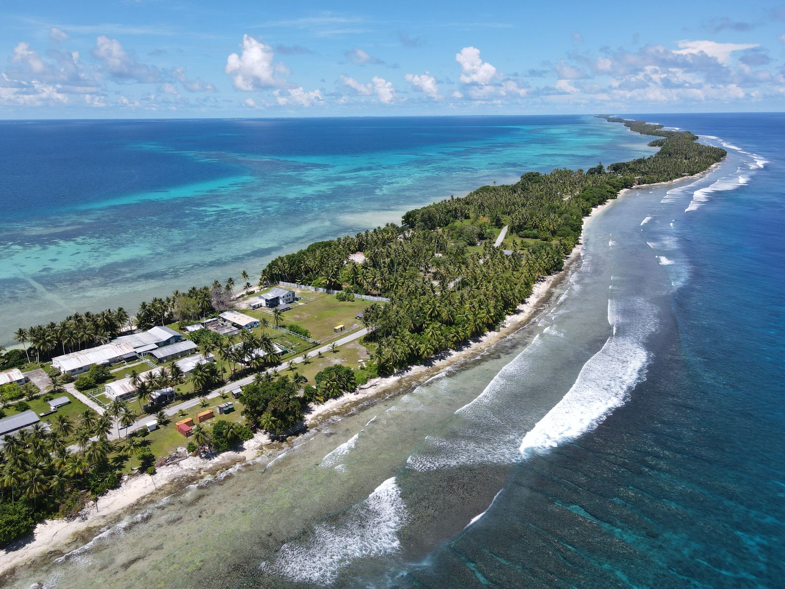
The Marshall Islands is a remote Micronesian nation of 29 atolls and 5 islands scattered across 1.9 million square kilometres of the western Pacific — perhaps best known for the Bikini Atoll nuclear test site (a sobering UNESCO World Heritage Site where the USA detonated 23 nuclear devices between 1946 and 1958) and as one of the world’s most threatened nations by rising sea levels. Majuro Atoll is the capital and commercial hub; Bikini Atoll, accessible by chartered plane, has extraordinary wreck diving on ships sunk in the nuclear tests including the 270-metre aircraft carrier USS Saratoga and the Japanese battleship Nagato. The Marshall Islands’ stick-chart navigation tradition — where ancient Marshallese navigators used woven coconut-frond charts to read ocean swell patterns across hundreds of miles of open Pacific — is one of humanity’s most sophisticated non-instrument navigation systems.
A UNESCO World Heritage Site of grim historical significance — the lagoon of Bikini Atoll, where 167 Marshallese were displaced and 23 nuclear weapons detonated between 1946–1958, now contains the world’s most dramatic wreck diving fleet: the aircraft carrier USS Saratoga (270m, the world’s largest diveable wreck), the battleship Nagato, submarines and support ships rest on the lagoon floor between 15 and 55 metres, heavily encrusted with coral. An extraordinary and sobering experience.
The capital atoll is a narrow strip of land (average width 200m) ringing a massive lagoon — the classic Pacific atoll experience of palm-fringed sandbanks, excellent snorkelling on the outer reef and the Alele Museum’s collection of stick charts and traditional artefacts. The Laura Beach at the atoll’s far western end is the best beach in the Marshalls.
in season, roasted or boiled) is the staple carbohydrate;
in every form — fresh, dried, as oil and as toddy (fermented coconut sap) — is universal. Fresh
The Marshall Islands’ waters are among the world’s most productive yellowfin tuna grounds — eaten raw as sashimi, grilled over charcoal, or canned for export. The freshest tuna available to outer island communities is often eaten within hours of landing.
Parrotfish, grouper and trevally caught daily from the atolls — the primary protein for outer island communities, grilled over coconut shells, eaten raw with lime, or preserved in salt for transport between atolls. The freshness is extraordinary when caught at dawn.
is a delicacy. Imported American food dominates urban Majuro — the legacy of a US trust territory relationship that lasted until 1986.
Marshall Islands International Airport (MAJ) on Majuro is the main gateway. United Airlines serves the main route via Honolulu on the historic Island Hopper flight. For trip planning, see the official Marshall Islands tourism portal.
💡 The United Island Hopper (HNL–MAJ via Johnston Atoll, Majuro — or the westbound Honolulu–Guam via Majuro, Kosrae, Pohnpei, Chuuk) is one of the world’s most remarkable commercial flights, crossing the central Pacific with multiple atoll landings. Majuro is a stop on the eastbound and westbound routes.
💡 The Island Hopper is the most reliable connection; Guam is reachable by the westbound flight. Fiji and other Micronesian nations require multi-hop connections through Honolulu or Guam.
💡 Bikini Atoll is only accessible via a licensed live-aboard dive operation (Bikini Atoll Divers — the only permitted operator) which arranges charter flights, dive permits and the required radiation safety briefing. Independent access is not permitted.
💡 Majuro’s single road runs the 56km length of the atoll; a car hire gives full access to Laura Beach and the western end. Outer atoll visits require boat or domestic flight bookings through local operators.
Year-round is warm (27–30°C) with no true dry season on the northern atolls. January to March is the driest and calmest period. May to November brings higher rainfall. November to April is best for diving visibility. The Bikini Atoll nuclear dive sites are accessible year-round.
The US dollar is the currency. Modestly priced in Majuro; the Bikini Atoll trip is expensive due to the charter flight and specialised dive operation.
Coconut crab (Birgus latro — the world’s largest terrestrial arthropod, up to 4kg, which climbs coconut palms and cracks open coconuts with its claws — a Marshallese delicacy available at local restaurants when in season, for)
The Marshallese stick chart (mattang and rebbelib — woven palm-rib frameworks encoding ocean swell patterns used for open-ocean navigation — are available as artisan souvenirs from the Alele Museum for US$15–80,)
The Bikini Atoll live-aboard dive trip.
Majuro for two days, Arno Atoll for one, Bikini Atoll for two days, Kwajalein for one, Majuro farewell for one. The Marshall Islands — site of 67 nuclear tests — has the most historically haunting dive sites on earth at Bikini Atoll, the most sophisticated pre-modern navigation system in the Pacific and the most urgent climate crisis frontline in the world.
Majuro — the capital of the Marshall Islands (an independent nation of 181 atolls and islands in the central Pacific, population 42,000, a former US Trust Territory independent since 1986 under a Compact of Free Association with the USA) — itself a coral atoll, with a land area of only 9.7km² but enclosing a lagoon of 295km², the capital city spread across a narrow strip of coral just 200m wide in places — with the Alele Museum (covering Marshallese navigation history and the nuclear testing legacy) and the local market.
💡 The Marshall Islands is the most affected nation in history from nuclear weapons testing — the US conducted 67 nuclear tests on Bikini and Enewetak atolls between 1946 and 1958, including the 15-megaton Castle Bravo hydrogen bomb test of 1954 (the largest US nuclear detonation ever, 1,000 times more powerful than the Hiroshima bomb), which contaminated the crew of a Japanese fishing vessel and the inhabitants of Rongelap Atoll with radioactive fallout. The nuclear testing legacy continues to define Marshallese identity and its relationship with the USA.
A full day on the Majuro Lagoon (sailing or kayaking inside the atoll — the lagoon is 295km² of calm, clear water with white sand islets (motu), coral bommies and the finest atoll snorkelling in the central Pacific — Laura Beach at the far western end of the atoll, the finest beach in the Marshall Islands, with the Laura Beach park and the traditional canoe-building community at the western tip).
💡 The Marshallese outrigger canoe (the traditional walap and tipnol sailing canoe — the most sophisticated pre-European sailing vessel in the Pacific, capable of sailing precisely into the wind using a reversible sail system that allowed the canoe to sail in any direction relative to the wind — and the stick charts (rebbelib and mattang) used for Marshallese navigation: woven frameworks of palm ribs representing ocean swells and wave patterns that allowed Marshallese navigators to cross 2,000km of open ocean without instruments) are the most remarkable pre-modern navigation technology in Pacific history.
Arno Atoll (the closest outer atoll to Majuro — 45 min by speedboat, a remote atoll of 133 islets enclosing a lagoon of 340km², with the finest coral in the Marshall Islands, green and hawksbill turtle nesting beaches, the most remote and traditional Marshallese village community accessible from Majuro, and snorkelling over pristine coral at 1–3m that has rarely been visited by outside divers) and overnight in the community guesthouse.
💡 The outer atolls of the Marshall Islands (only 1% of which are inhabited year-round) contain some of the least-disturbed coral reefs in the central Pacific — the combination of extreme remoteness, very low population density and the absence of commercial fishing has preserved reef ecosystems that have changed very little since European first contact in the 16th century.
Charter flight to Bikini Atoll (UNESCO World Heritage — the site of 23 US nuclear weapon tests 1946–1958, now an extraordinary dive destination: the wrecks of the US battleship USS Saratoga (270m long, lying at 55m — the world’s most dived aircraft carrier wreck), the Japanese battleship Nagato (Admiral Yamamoto’s flagship, at 55m), and the USS Arkansas lying upside down at 55m — all contaminated by low-level radioactivity but safe for recreational diving by current standards).
💡 The Castle Bravo nuclear test at Bikini Atoll (1 March 1954 — a 15-megaton thermonuclear device, the largest US nuclear test in history, detonated on the reef surface rather than from a tower, producing a fireball 7km in diameter and a crater 2km wide — the yield was 2.5x larger than predicted because the weapon designers had not accounted for the lithium-7 contribution to the yield) contaminated 7,000km² of ocean and forced the evacuation of Rongelap and Utirik atolls. The contamination at Bikini remains above safe habitation levels today.
Two days of diving the Bikini Lagoon ghost fleet (the most historically significant wreck diving in the world: the USS Saratoga (CVA-3 — the 270m aircraft carrier, sunk in the Baker test of 1946, lying on its side at 55m with the aircraft still on the hangar deck), the Nagato (IJN battleship from which Yamamoto commanded the Pearl Harbor attack, now at 55m on the lagoon floor), and the bomb craters on the atoll reef still visible 70 years after detonation).
💡 Bikini Atoll was inscribed as a UNESCO World Heritage Site in 2010 as a monument to the nuclear age — the only UNESCO site primarily significant as evidence of the destructive potential of nuclear weapons. The Bikini Atoll people (displaced to Rongerik Atoll in 1946, subsequently near-starved on the barren atoll, eventually resettled on Kili Island) have been unable to return to Bikini due to residual contamination; soil contamination from caesium-137 (half-life 30 years) remains above safe habitation levels.
Kwajalein Atoll (the world’s largest atoll by lagoon area — 2,174km² lagoon — and the site of the US Army Garrison Kwajalein Atoll (USAKA), where US intercontinental ballistic missiles are test-fired from California and intercepted over Kwajalein Lagoon — one of the most unusual inhabited military installations in the world, a tropical atoll functioning as a missile test range, accessible to civilians only with special permits or through Majuro connecting flights).
💡 Kwajalein Atoll was the site of one of the bloodiest battles of the Pacific campaign (1–7 February 1944 — US forces landed on Roi-Namur and Kwajalein island, overrunning the Japanese garrison in 8 days in fighting that killed 7,869 Japanese soldiers and 373 Americans). The atoll remains US military territory under the Compact of Free Association; Marshallese citizens cannot live on Kwajalein island itself, though they can live on Ebeye Island adjacent to the US base.
A final day in Majuro focused on the Marshall Islands’ climate crisis (the average elevation of Majuro is 2m above sea level — the Marshall Islands is among the first nations expected to become uninhabitable from sea level rise, with storm surges already flooding the capital, salt water intrusion poisoning the freshwater lens, and the government purchasing land in Fiji as a potential relocation site) and the Marshallese cultural response — the traditional woven handicrafts and the stick chart navigation heritage. Fly from Majuro (MAJ).
💡 The Marshall Islands government has been a leading voice in international climate negotiations — the 2015 Paris Agreement included, at Marshallese insistence, the 1.5°C temperature target rather than 2°C, which the Marshallese argued would still cause unacceptable sea level rise for low-lying atolls. President Hilda Heine’s statement at COP21 (“1.5 to stay alive”) became the rallying cry for small island nations threatened by sea level rise.
Visa-free for US citizens; visa-on-arrival or permit for others. US Compact of Free Association governs many entry arrangements.
United Airlines and Nauru Airlines serve Majuro. The country spans 1,156 islands across 2 million km² of ocean; most atolls require additional transport.
Marshall Islands is one of the world’s most vulnerable nations to sea-level rise. Many atolls are just 2 metres above sea level. The existential climate threat makes this a historically significant time to visit.
The Marshalls use USD. Card acceptance is limited outside Majuro; carry cash.
Accessible by chartered plane from Majuro; diving requires booking 6–12 months in advance through specialist operators due to limited access.
The Marshall Islands faces existential threat from sea-level rise — many atolls are already experiencing regular flooding. The Marshallese government is relocating planning discussions to Fiji.
For identifying the extraordinary marine biodiversity around the atolls.
FreePoint your camera at menus, signs or street text for instant translation. Download the language pack offline before you arrive for full use without data.
FreeReal-time and offline exchange rates for all world currencies — converts prices instantly so you always know what you are paying in your home currency.
FreeFind and book hotels, guesthouses and apartments with free cancellation on most rates — one of the widest selections of accommodation worldwide.
FreeBrowse millions of traveller reviews for restaurants, attractions and hotels — helps identify the best local spots and avoid tourist traps.
FreeMarshall Islands sits within easy reach of several other destinations — each with a completely different character.