FO
Faroe Islands
Sea stacks, turf-roofed villages & 10 million puffins in the wild North Atlantic
Sea stacks, turf-roofed villages & 10 million puffins in the wild North Atlantic
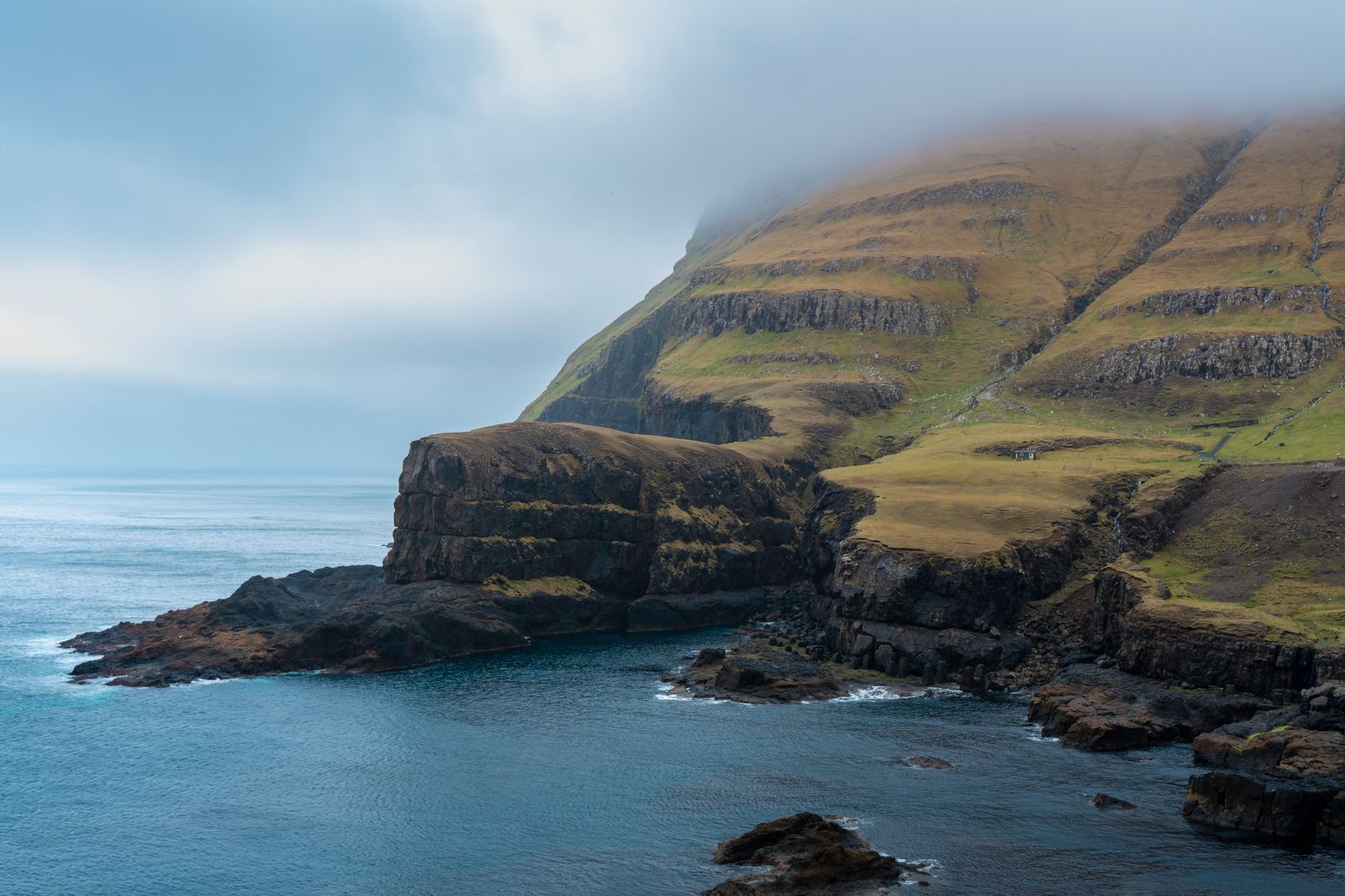
The Faroe Islands is 18 volcanic islands in the North Atlantic between Iceland and Norway — a self-governing Danish territory of extraordinary raw beauty, where sea stacks, sea cliffs, waterfalls and turf-roofed villages tumble from dramatic heights into the ocean. The Faroes are one of Europe’s last truly wild destinations: barely 55,000 inhabitants, almost no mass tourism infrastructure, birds that outnumber people (10 million puffins nest here), and an authenticity of landscape and culture that makes it feel genuinely remote. The cliffs of Vestmanna, the lake of Sørvagsvatn (which appears to float above the ocean in photographs), the village of Gjógv perched above a natural harbour gorge and the sea stacks of Drangarnir are among Europe’s most dramatic landscapes.
The lake of Sørvagsvatn appears in photos to hover above the sea — a trick of perspective that makes it the most-shared image in Faroese tourism. The hike from the Trælanípan cliff edge above it reveals the dramatic reality: the lake sits 40 metres above the ocean, and the cliff drops directly below. The views of Sørvagsvatn, the sea stacks and the surrounding cliffs are extraordinary in any weather.
Two extraordinary sea stacks accessible by boat from Sørvagur — Drangarnir rises 60 metres from the sea and was first climbed in 2016; Tindhólmur’s five pointed peaks rising from the Sorvagsfjord are one of the most recognisable shapes in Faroese photography.
A boat tour into the dramatic sea caves and sea caves of the Vestmanna cliffs on Streymoy reveals towering bird colonies (puffins, guillemots, kittiwakes) nesting on ledges hundreds of metres above, waterfalls cascading from the cliff tops and the extraordinary interplay of North Atlantic light and shadow in the cave passages.
One of the world’s smallest capitals — the Faroese capital has a tiny old town (Tinganes) of turf-roofed red wooden buildings on a peninsula that has been the seat of government since the 9th century Viking parliament. The Foroya Fornminnissavn museum and the excellent restaurant scene (KOKS, the Faroe Islands’ Michelin-starred restaurant, elevated Nordic-Faroese cuisine to international attention) make Tórshavn a rewarding base.
Faroe Islands (Wikipedia) →wind-dried and fermented lamb, aged in a hjallur — a wooden lattice shed) is the traditional Faroese method of food preservation; the result is a deeply funky, complex flavour unlike any other cured meat.
Pan-fried dough balls with lamb or fish filling — a traditional Faroese winter comfort food made at home and at market stalls.
The Faroese tradition of eating in local homes — several families have turned this into informal home-restaurant experiences, offering ræst fish, skerpikjøt and local potatoes in their own dining rooms. Unlike anything else in travel.
Mutton air-dried in a hjállur (wooden lattice shed) for 5–9 months in the Faroese wind and rain, developing an intensely complex, funky flavour with no parallel in European charcuterie. Carved thin and eaten with flatbread and butter.
fermented wind-dried fish) are acquired tastes of enormous cultural significance. Fresh Atlantic cod, haddock and salmon are outstanding;
puffin, sustainably hunted) in traditional recipes. The restaurant KOKS (now relocated but formerly on Leiró farm) defined a new chapter in Nordic gastronomy.
Vágar Airport (FAE) is the only airport. Atlantic Airways (Faroese national carrier) and Icelandair serve the main routes. No direct UK flights; Copenhagen and Reykjavik are the main gateways. For trip planning, see the official Faroe Islands tourism portal.
💡 Copenhagen is the primary gateway — Atlantic Airways operates multiple weekly CPH–FAE flights. Edinburgh (1h45, seasonal) is the best UK option. No direct London service; most fly via Copenhagen.
💡 The Smyril Line ferry (Norrøna) is the classic North Atlantic crossing from Denmark to the Faroe Islands and on to Iceland — 34h at sea, spectacular in good weather, wild in bad. Many combine it with Iceland for a North Atlantic island circuit.
💡 Gásadalur is just 30 minutes from Vágar Airport — the most dramatic landscape in the Faroe Islands is accessible in the first hour of arrival. Car hire from the airport is the best strategy.
💡 Car hire (DKK 450–700/day) is by far the best way to explore. The Faroe Islands have an extraordinary network of undersea tunnels connecting the main islands (some free, one with a toll), making the archipelago effectively driveable in a single day.
May to September is the best window — the puffins on the sea cliffs, the daylight extreme (22h in June), the waterfalls at their most powerful and the hiking trails accessible. June and July have the best weather (10–15°C), though fog and sudden squalls are always possible. October to April is wild and dramatic — spectacular for the determined.
The Faroe Islands use the Faroese króna (pegged to the Danish krone DKK at 1:1). It is one of the more expensive destinations in Europe — comparable to Iceland — but excellent-value stays are available in village guesthouses.
Heimablidi — a uniquely Faroese tradition (a home-dining concept where local families open their homes as informal restaurants, serving traditional food: skerpikjøt, roe soup, fermented lamb and fresh fish, at a long shared)
Skerpikjøt — wind-dried mutton (lamb hung in a wooden hjallur shed open to the North Atlantic wind for 3–9 months, developing a complex fermented flavour unlike any other cured meat) — is the defining Faroese delicacy.
Koks (Tórshavn, awarded a Michelin star in 2017 — the first Michelin star in the Faroe Islands — serving a tasting menu of exclusively Faroese ingredients: fermented lamb, dried fish roe, seaweed, guillemot egg and)
Tórshavn for two days, Gasadalur and Sørvágsvatñ for one, Kalsoy for one, Vestmanna sea cliffs for one, Saksun for one. The Faroe Islands — 18 volcanic islands between Norway and Iceland — have the most dramatic landscape in northern Europe and some of the most photogenic villages on earth.
Tórshavn — a capital of 22,000 people on the south coast of Streymoy, with the Tinganes (the oldest continuously occupied government site in Europe — wooden red-roofed buildings on a rocky promontory where the Faroese parliament, the Logting, has met since 825 AD), the old town of Nesgaard and the grass-roofed turf buildings of the historic quarter beside the harbour.
💡 The Faroese Logting (parliament) at Tinganes is one of the oldest functioning democratic assemblies in the world — it has met on this rocky promontory since approximately 825 AD, predating the Icelandic Althing (930 AD) and making it the oldest parliament in continuous existence. The Faroe Islands became an autonomous territory of Denmark in 1948; the Logting handles domestic affairs.
A short drive south on Streymoy. Kirkjubøur — the most historically significant site in the Faroe Islands, a medieval village at the foot of a cliff with the ruins of the Saint Magnus Cathedral (begun 1300, never completed, open to the sky, the largest medieval stone building in the Faroe Islands) and Kirkjubøargarður (a farmhouse occupied by the same family for 16 generations since the 11th century — claimed to be the oldest inhabited wooden house in the world).
💡 Kirkjubøargarður is claimed to be the oldest inhabited wooden house in the world — the Patursson family has lived in the same farmhouse since approximately 1100 AD, making 17 generations in the same building. Parts of the current structure date from the 11th century. The farm is still a working property.
1h30 from Tórshavn. Gásadalur — a remote village of 16 people on the western coast of Vagar island, accessible until 2004 only by a 6h mountain path over the ridge (a tunnel was finally bored in 2004), with the Mulafossur Waterfall (a waterfall that drops 30m directly off the cliff edge into the Atlantic — the most photographed landscape in the Faroe Islands, visible from the village path above).
💡 Gásadalur was completely isolated until 2004 — no road, only a steep mountain pass that required 6 hours to reach the nearest village. Letters arrived once a week carried by a postman on foot over the mountain. The tunnel drilled in 2004 transformed the village from one of the most isolated in Europe to a tourist destination; the population has remained at approximately 16.
1h from Tórshavn on Vagar. Sørvágsvatñ (also called Leitisvatn — a lake that from a specific viewpoint appears to be elevated above the Atlantic Ocean due to an optical illusion created by the cliff perspective, making it look like the lake surface is 100m above sea level when it is actually only 30m above). The 90-min hike to the viewpoint and Bøsdalafossur (where the lake drains over the cliff into the sea in a waterfall).
💡 The Sørvágsvatñ optical illusion is one of the most photographed photography tricks in Europe — from the correct viewpoint on the ridge walk, the lake appears to float above the Atlantic. The effect is created by the cliff perspective: the near edge of the lake is at eye level while the far drop to the sea is visible beyond, creating the illusion of elevation.
Ferry from Klaksvik. Kalsoy — a narrow island called the flute (kalsurin) for its shape, with four villages connected by single-lane tunnels, the Kallur Lighthouse (a lighthouse at the northern tip of the island, accessible by a 2h hike from the village of Trollanes, with views of the puffin colonies on the surrounding sea stacks and the dramatic cliffs of northern Kalsoy) and the Selkie memorial at Mikladalur.
💡 The Faroese legend of the Selkie (seal-people who shed their skins to come ashore as humans) is most strongly associated with Mikladalur on Kalsoy. The statue at Mikladalur depicts Kopakonan (the Seal Woman), who returns each year to the sea after a captivity with a human man. The legend is shared across all North Atlantic island cultures from Scotland to Iceland.
1h from Tórshavn. Vestmanna sea cliffs — a boat tour from Vestmanna harbour along the most dramatic sea cliff faces in the Faroe Islands (300m vertical basalt cliffs with guillemots, razorbills, kittiwakes and gannets nesting in their thousands on every ledge, the boat threading through narrow sea caves and beneath overhanging cliff faces dripping with waterfalls).
💡 The Faroe Islands hold some of the largest seabird colonies in the North Atlantic — approximately 600,000 puffins nest in the islands, the second-largest Atlantic puffin colony after Iceland. The gannet colony at Mylingur is the southernmost in the North Atlantic. The seabird cliff at Enniberg on Vioy is at 754m the highest sea cliff in the world with a sheer vertical drop to the ocean.
45 min from Tórshavn. Saksun — a village of 14 people at the head of a tidal fjord that was once a busy harbour before sand accumulated and blocked the channel, leaving a circular tidal lagoon surrounded by turf-roofed farmhouses and the Duvugardar farm (a preserved traditional Faroese farmstead, turf-roofed, furnished as it was in the 19th century) as the most photogenic village in the Faroe Islands. Fly from Vágar (FAE).
💡 The turf-roofed buildings of the Faroe Islands (using a layer of birch bark under the turf, supported by a wooden frame — the turf insulates, the birch bark waterproofs) are the architectural symbol of the islands. The style survives in modern Faroese buildings — the Nordic House cultural centre in Tórshavn has a contemporary turf roof, as does the new parliament extension.
Not part of EU but part of the Nordic Passport Union — UK, EU, US, Australian citizens enter visa-free.
Atlantic Airways serves the Faroes. From FAE, the 40-minute bus connects to Tórshavn via a subsea tunnel.
Bring waterproofs regardless of forecast. Fog, rain and sun can alternate within an hour. The Faroes are one of the windiest places in Europe.
The Faroe Islands have built a network of subsea tunnels connecting the islands — driving underwater roundabouts (the world’s first) is a surreal and only-in-Faroes experience.
There are approximately 80,000 sheep and 54,000 people in the Faroes. The sheep have right of way on most roads.
The Faroes have 4 seasons in one day; bring waterproof layers regardless of the forecast. Summer (May–Aug) offers the best light and accessibility.
Car hire is ideal — the islands are connected by tunnels (including a spectacular subsea roundabout tunnel). Ferries link the outer islands.
Official tourism app with hiking trails, weather and transport maps.
FreeDownload offline maps before you travel so navigation works without mobile data — essential for walking, driving and finding local spots.
FreePoint your camera at menus, signs or street text for instant translation. Download the language pack offline before you arrive for full use without data.
FreeReal-time and offline exchange rates for all world currencies — converts prices instantly so you always know what you are paying in your home currency.
FreeFind and book hotels, guesthouses and apartments with free cancellation on most rates — one of the widest selections of accommodation worldwide.
FreeFaroe Islands sits within easy reach of several other destinations — each with a completely different character.