NR
Nauru
World’s smallest republic — phosphate moonscape, WWII relics & pristine reef
World’s smallest republic — phosphate moonscape, WWII relics & pristine reef
Nauru is the world’s smallest island nation — a single raised coral island of 21 square kilometres in the central Pacific, and one of the strangest travel destinations on earth. Once the world’s richest per capita nation (briefly, in the 1970s–80s, when phosphate revenues made every Nauruan wealthy), Nauru spent its fortune and its phosphate simultaneously, leaving the island’s interior a moonscape of mined-out coral pinnacles and the country with one of the world’s highest rates of obesity and diabetes. The island’s phosphate mining history, its WWII Japanese occupation (where Nauruans were deported to Truk as forced labour and most never returned), its brief flourish of extreme wealth and its subsequent decline make it one of the Pacific’s most sobering and fascinating stories. The fringing reef has excellent snorkelling and diving, largely undiscovered.
The interior of Nauru is a cathedral of white coral pinnacles (topside) left behind when the phosphate rock between them was excavated — a surreal, alien landscape that covers most of the island’s interior. Walking through the pinnacle forest at dawn is one of the Pacific’s most otherworldly experiences, a monument to extraction economics run to its logical end.
Japanese gun emplacements, bunkers and a railway used for phosphate haulage survive around the island from the 1942–1945 occupation. The Command Ridge area has the best-preserved Japanese fortifications; the old phosphate railway tracks along the coast are good for cycling.
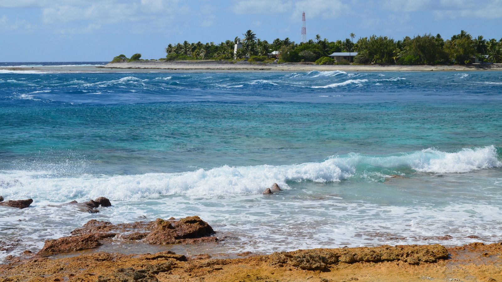
Nauru’s fringing reef is an unheralded diving and snorkelling destination — the reef drop-off (accessible from the island’s narrow beach) has excellent coral and fish diversity, very rarely dived and genuinely pristine in sections.
Nauru (Wikipedia) →in traditional preparations and fried fish at the island’s few restaurants are the local options. The OD-N-Aiwo Hotel is the main dining venue for visitors.
The world’s largest land invertebrate, a coconut-climbing robber crab — a prized traditional food source on Nauru and Pacific islands, though populations are declining from overhunting.
Flying fish caught by traditional torchlight fishing at night, deep-fried and eaten with rice — a rare taste of traditional Nauruan food that predates the phosphate era.
Breadfruit fermented in a sealed pit for months, then cooked with coconut cream — a traditional Micronesian long-shelf-life food that predates refrigeration and sustained Pacific voyagers during droughts.
Sooty terns and noddy terns have been traditionally harvested on small Pacific islands during nesting season — a traditional food source specific to Micronesian islands.
Nauru International Airport (INU) is served by Nauru Airlines from Brisbane and Tarawa. Flights are infrequent; planning around the schedule is essential. For trip planning, see the official Nauru tourism portal.
💡 Nauru Airlines (the national carrier, operating a small jet on the Brisbane–Nauru route twice weekly) is the only practical connection from Australia. The limited frequency means careful planning around the schedule; most visitors stay a minimum of 4 nights.
💡 Tarawa, Kiribati (1h30) is the nearest hub and makes a natural combination with Nauru for central Pacific island collectors. Fiji (4h) and Brisbane (5h) are the main practical gateways.
💡 Nauru is tiny — the entire island takes 30 minutes to drive around. A hired car or taxi for a full day (AUD 30–60) covers every accessible site. The airport is within walking distance of the centre.
💡 Nauru is one of the few countries in the world small enough to walk completely around — the 19km coast road takes 4–5 hours at a comfortable pace. Early morning walking avoids the equatorial heat.
November to April is slightly wetter; May to October is the drier period. The island is equatorial (28–30°C year-round) with no real dry season. The airport schedule determines practical visit windows.
The Australian dollar (AUD) is the currency. Affordable but options are extremely limited.
Nauruan noddy (the black noddy tern Anous minutus, which roosted in enormous numbers on Nauru before the phosphate mining began and whose guano created the phosphate deposits that made the island temporarily the richest country on earth)
Nauru is unusual among Pacific micro-nations in being genuinely informative about its own catastrophic environmental and economic history &mdash.
Nauru’s outer reef (the coral reef surrounding the island, accessible only by boat &mdash)
Yaren for one day, phosphate plateau for one, Buada Lagoon for one, coastal walk for one, Anibare Bay for one, processing centre history for one, departure for one. Nauru — the world’s third-smallest country — had the highest per-capita income on earth in 1980 from phosphate, stripped 80% of its surface in 90 years of mining, and now earns its income from hosting an Australian offshore asylum detention centre.
Yaren — the de facto capital of Nauru (a micro-nation of 21km² — the third-smallest country in the world, 4,000km northeast of Australia, population 10,000, an independent republic since 1968 — a raised coral island made almost entirely of phosphate rock, with a history defined by the exploitation and depletion of that phosphate and the resulting cycle of extreme wealth and poverty) with the Nauru Phosphate Corporation ruins and the Parliament House.
💡 Nauru had the highest per-capita income in the world in the early 1980s — the phosphate royalties produced a GDP per capita higher than Saudi Arabia, which the Nauru government spent on a national airline, luxury cars (with no road longer than 30km), overseas real estate investments and a welfare state with no taxes. When the phosphate ran out in the 1990s, the investments had mostly failed, the national airline collapsed, and Nauru became dependent on Australian aid in exchange for hosting Australian offshore asylum seeker processing.
The phosphate mining plateau (the interior of the island, stripped to bare pinnacles of coral limestone (the “topside”) by 90 years of phosphate extraction — a desolate moonscape of jagged white limestone pillars, the most dramatic environmental degradation on any inhabited island, covering 80% of the land surface — with the rusting mining equipment, the broken conveyor belts and the ghost infrastructure of the Nauru Phosphate Corporation still present across the plateau).
💡 The Nauru phosphate deposits (accumulated over millions of years from bird guano deposited on the raised coral island, creating a layer of calcium phosphate up to 15m thick covering 80% of the island) were first mined commercially in 1906 under German colonial rule. By the time phosphate production peaked in the 1970s, the annual production was 2 million tonnes; by 2016 the economically accessible deposits were largely exhausted. Rehabilitation of the stripped interior has barely begun.
Buada Lagoon (the only inland body of water on Nauru — a brackish freshwater lake in the island’s interior, surrounded by pandanus and banana trees, the most peaceful and green spot on the island, a roosting area for the endemic Nauru reed warbler (Acrocephalus rehsei — found only on Nauru, one of the rarest endemic birds in the Pacific) and a traditional freshwater fishing area for local families) and the traditional community meeting house.
💡 The Nauru reed warbler (Acrocephalus rehsei — endemic to Nauru, found only in the remaining pandanus and vegetation around Buada Lagoon and the coastal fringe, population estimated at fewer than 10,000 individuals and declining with vegetation loss) is the most visible endemic bird in Nauru and the primary wildlife attraction on the island.
A complete circuit walk of the coast road (the road circles the entire island in 19km — the most accessible circumnavigation of any independent nation on earth, taking 4–5 hours on foot — passing the phosphate loading cantilevers, the Japanese WWII command post ruins, the Anibare Bay beach (the only sandy beach on Nauru, with sea turtles nesting at night), the Chinese workers’ quarters and the characteristic Nauruan residential areas with their Australian-donated houses and Japanese cars).
💡 Nauru’s Japanese WWII occupation (August 1942 – September 1945 — Japanese forces occupied Nauru and deported 1,200 Nauruans to Truk as forced labourers, of whom 463 died; the Japanese also executed all remaining Nauruan leaders) has left numerous concrete bunkers, gun emplacements and the command post near Yaren still visible and accessible, the most complete surviving WWII Japanese fortification on a small Pacific island.
Anibare Bay (the finest and only sandy beach on Nauru — a broad crescent on the eastern coast, the leeward side of the island, with a fringing reef for snorkelling, the most intact coral in Nauru’s EEZ accessible from shore, sea turtle nesting November–January, and the Menen Hotel beach — the only beach resort facility on the island) and traditional Nauruan fishing (hand-line fishing for tuna from the reef edge, the primary protein source for Nauruan families).
💡 Nauru has the world’s highest rate of type 2 diabetes (approximately 40% of the adult population) and the world’s highest obesity rate — the direct result of the phosphate boom years (1970–1990) when imported processed food replaced traditional fishing and agriculture, and the subsequent decline in the economy that maintained the food culture without the income. Nauruan traditional food (freshwater eels from Buada Lagoon, coconut crab, fresh tuna) is still available but represents a small part of the current diet.
The Regional Processing Centre (Nauru’s offshore immigration processing facility for Australian asylum seekers — opened 2001, closed 2008, reopened 2012, providing substantial income for the Nauruan government in exchange for hosting asylum seekers transferred from Australian waters — the most controversial aspect of Nauru’s contemporary identity, the source of the majority of the island’s current government revenue and the reason Nauru remains politically relevant in the Australian domestic immigration debate).
💡 Nauru’s Australian Processing Centre deal (the Australian government pays approximately AUD 400–500 million per year to Nauru for hosting the Regional Processing Centre — a sum equivalent to approximately AUD 40,000–50,000 per Nauruan resident per year, dwarfing the GDP of any other activity on the island — is the primary income source for the Nauruan government and has replaced phosphate as the basis of the economy since 2013.
A final morning in Nauru: the phosphate loading facility and the harbour (the only entry point for goods and the last remnant of the phosphate export infrastructure), the Nauru government building and a final coffee at the one cafe in Yaren before flying from Nauru (INU) via Brisbane or Tarawa (Kiribati).
💡 Nauru is listed by the International Monetary Fund as one of the least economically developed countries in the Pacific, yet its residents have free healthcare, free education and no income tax — subsidised entirely by the Australian Regional Processing Centre fees. The island has attempted to diversify its economy through online banking licenses (some controversial), a satellite internet company and deep-sea mining exploration of its EEZ.
Nauru Airlines operates flights from Brisbane and Honiara. Fewer than 200 tourists visit each year — one of the world’s least-visited countries.
Nauru is the world’s smallest island nation and one of the least visited countries on earth. There are no tourist attractions in the formal sense and minimal hotel options. Visit as an adventure in genuine remoteness.
Nauru Airlines is the only carrier; connects to Brisbane and other Pacific Islands.
Three-quarters of the island’s interior is a moonscape of coral pinnacles from phosphate mining that exhausted the island’s resources in the 1980s. The contrast with the inhabited coastal strip is stark.
Visa on arrival for most nationalities; the immigration process can be slow.
Point your camera at menus, signs or street text for instant translation. Download the language pack offline before you arrive for full use without data.
FreeReal-time and offline exchange rates for all world currencies — converts prices instantly so you always know what you are paying in your home currency.
FreeFind and book hotels, guesthouses and apartments with free cancellation on most rates — one of the widest selections of accommodation worldwide.
FreeBrowse millions of traveller reviews for restaurants, attractions and hotels — helps identify the best local spots and avoid tourist traps.
FreeThe most widely used messaging app worldwide — used heavily for bookings, tour operators and local contact throughout most of the world outside the US.
FreeNauru sits within easy reach of several other destinations — each with a completely different character.
